
Tadala Makuluni & Nyasa Aerial Data Solutions


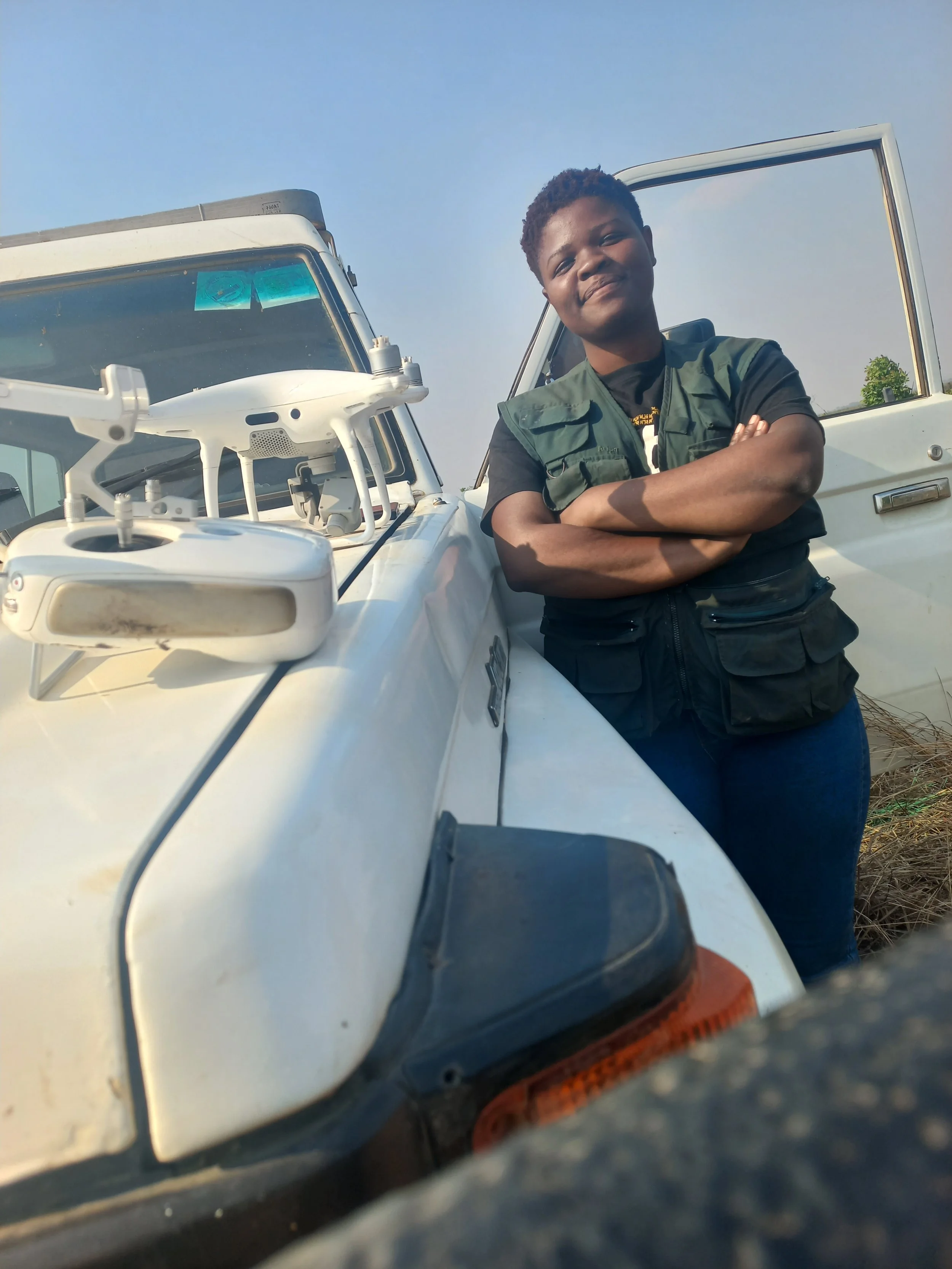


Tadala Makuluni, an environmentalist and drone pilot from Malawi, is dedicated to leveraging technology for sustainable development. With expertise in environmental forestry and GIS mapping, she leads initiatives using drones to restore degraded landscapes, monitor forests, and support disaster response. Tadala is also the founder of Nyasa Aerial Data Solutions, a pioneering business using drone technology for environmental solutions in Malawi.
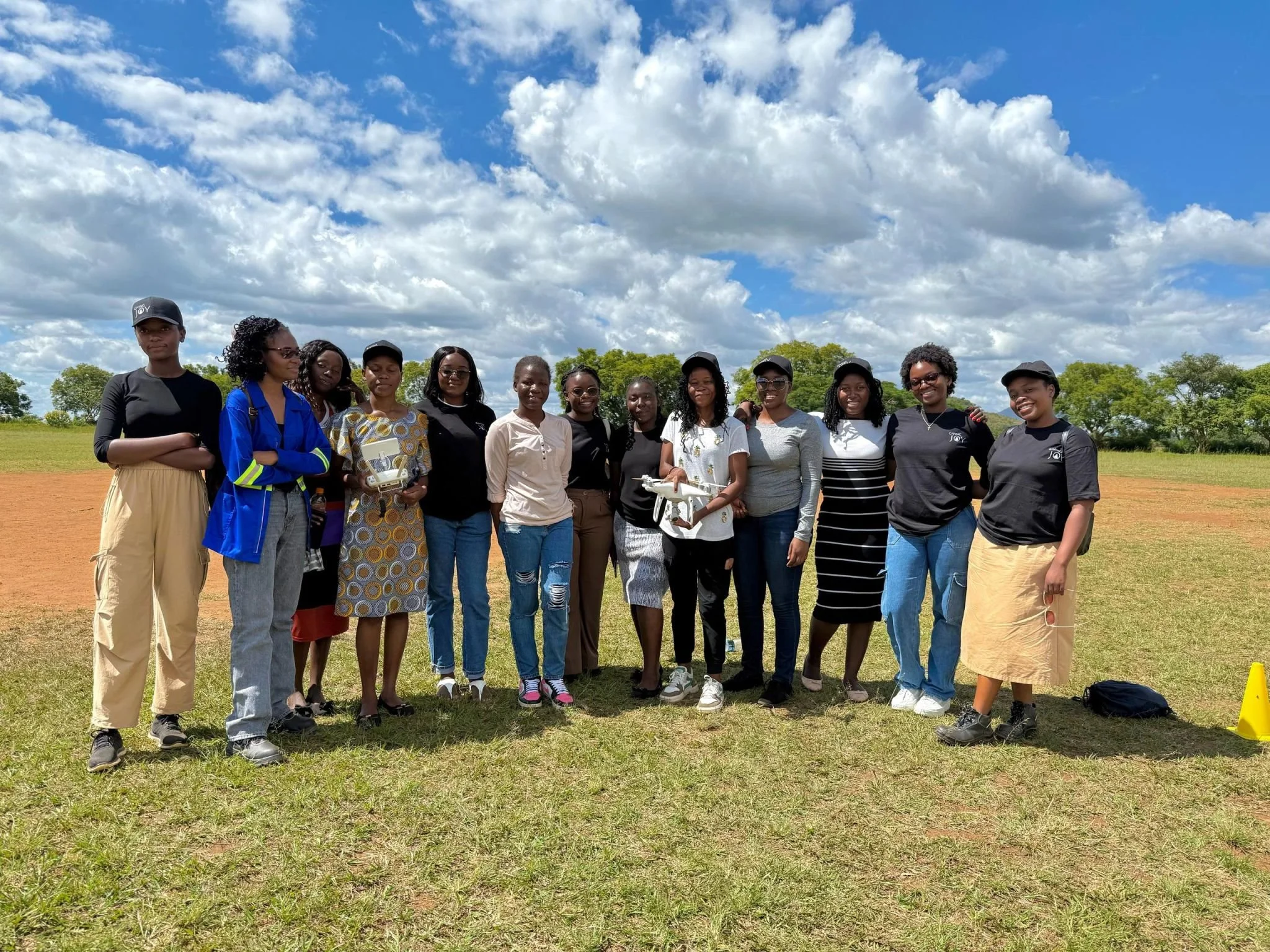
With support from our Giving Joy grant, Tadala launched an innovative program to equip young women with hands-on skills in drone technology, Geographic Information Systems (GIS), and remote sensing. From a competitive pool of 151 applicants, 20 highly motivated participants were selected to gain real-world experience in using geospatial tools for environmental monitoring and sustainable land use.
In partnership with the Spatial Girls Network, a local initiative dedicated to broadening access to geospatial knowledge, Tadala and team launched the “Phukira” (or sprouting in English) program that combined interactive lessons with field-based drone mapping activities, giving participants practical experience in drone assembly, flight safety, aerial data collection, and GIS analysis.
The Giving Joy grant was instrumental in producing high-quality instructional materials, including video tutorials and presentations, hosted on Google Classroom for easy access and continued learning. The team also conducted extensive outreach, attracting a diverse applicant pool and raising awareness about the opportunities in environmental technology.
The impact of the program has already begun to ripple outward. Many participants had never interacted with drone or GIS technology before, but have since used their new skills to apply for internships, jobs, or share knowledge within their communities. Graduates are now better equipped for careers in environmental monitoring, agriculture, and conservation, and are inspiring others to explore opportunities in STEM. For example, one participant created a GIS-based project addressing waste collection in her community, while another developed a mapping solution for climate resilience.
Looking ahead, Tadala and the Spatial Girls network plan to expand the program to reach even more youth and women, continue building partnerships, and host a graduation ceremony to recognize the achievements of their first cohort. Their work shows how access to digital tools and inclusive education can help transform lives and communities from the ground up.
“As a geologist, I joined the Phukira program to expand my technical skills—but I gained so much more. The hands-on experience with GIS and drone technology has transformed how I approach mapping and analysis. It’s empowering to apply these tools in ways that bring innovation to my field. Being part of a community of women in geosciences has also been incredibly inspiring.”
— Naysha Chulu, Phukira Program Participant
“Phukira truly lived up to its name—it helped me sprout in the field of geotech. From mastering GIS tools to learning how to use drones for mapping, every part of the program exceeded my expectations. The hands-on learning and tech-based delivery opened my eyes to what’s possible in this field. I now feel more confident than ever to pursue my dream of starting a GIS consultancy and continue learning through online platforms. This experience has been a turning point for me.”
— Christophina Gopani, Phukira Program Participant